So it turns out that moving and starting a new job is a really involving process! The blog got put on the back burner for a while, but it’s been percolating back there for a while and a new post is finally done.
Today is the one-year anniversary of our first steps on the Appalachian Trail. In honor of that amazing and life-changing event….without further ado, our last full day on the Appalachian Trail.
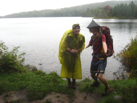
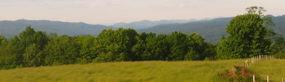
 We spent our last day of our Appalachian Trail adventure in the southern Presidentials of the White Mountains. We hiked about eleven miles that day, almost all of it above treeline.
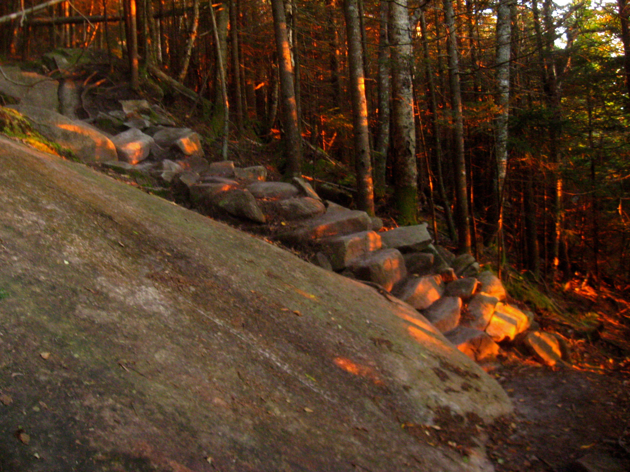
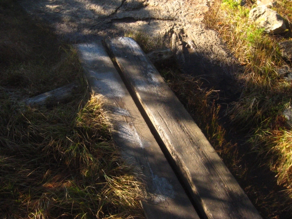
The day got an auspicious start when we began our morning work-for-stay chores at Mizpah Spring Hut. The generous crew members informed us that there were no leftovers from breakfast, but that they would be making more just for us! After we finished sweeping, we wolfed down an amazing pan of breakfast hash, complete with potatoes, vegetables, and eggs. It gave us an extra kick as we started out in the cool morning air. There was frost on the boardwalks (above), but the day was clear and sunny.

Sign text: Welcome to the Alpine Zone. Enjoy the fragile beauty. Be a caring steward. Stay on the trail or walk on bare rocks. Camp only below timberline. Cook on a stove. Help preserve the delicate balance of the Alpine Zone. It’s a tough place to grow.

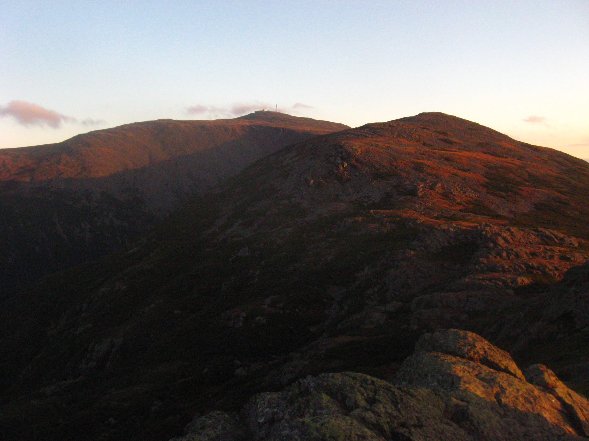
Behind us, a view of the peaks we would climb that day. Mt. Eisenhower is the closest one, while Mt. Washington rises in the distance.

Looking back–way back–to the Franconia Ridge.
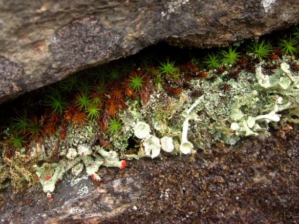
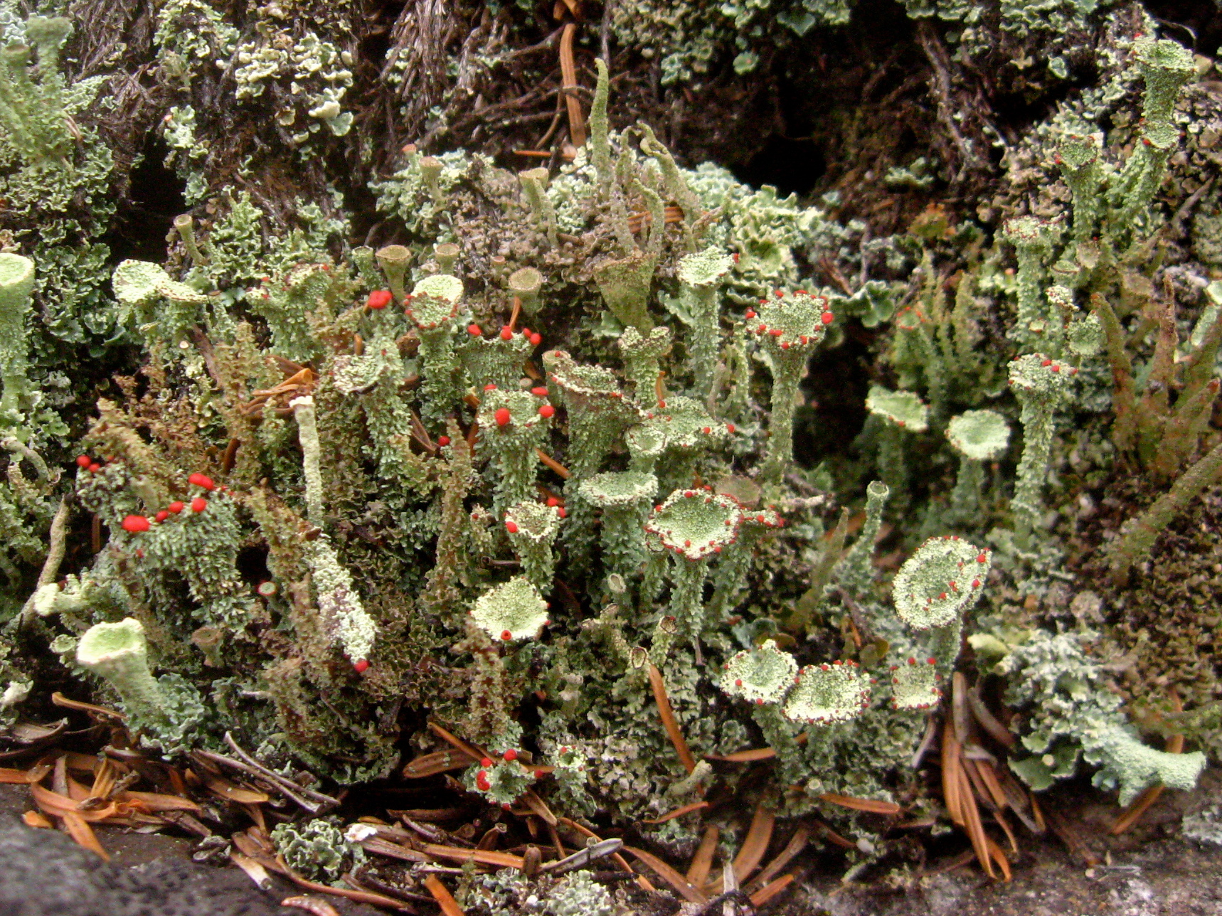
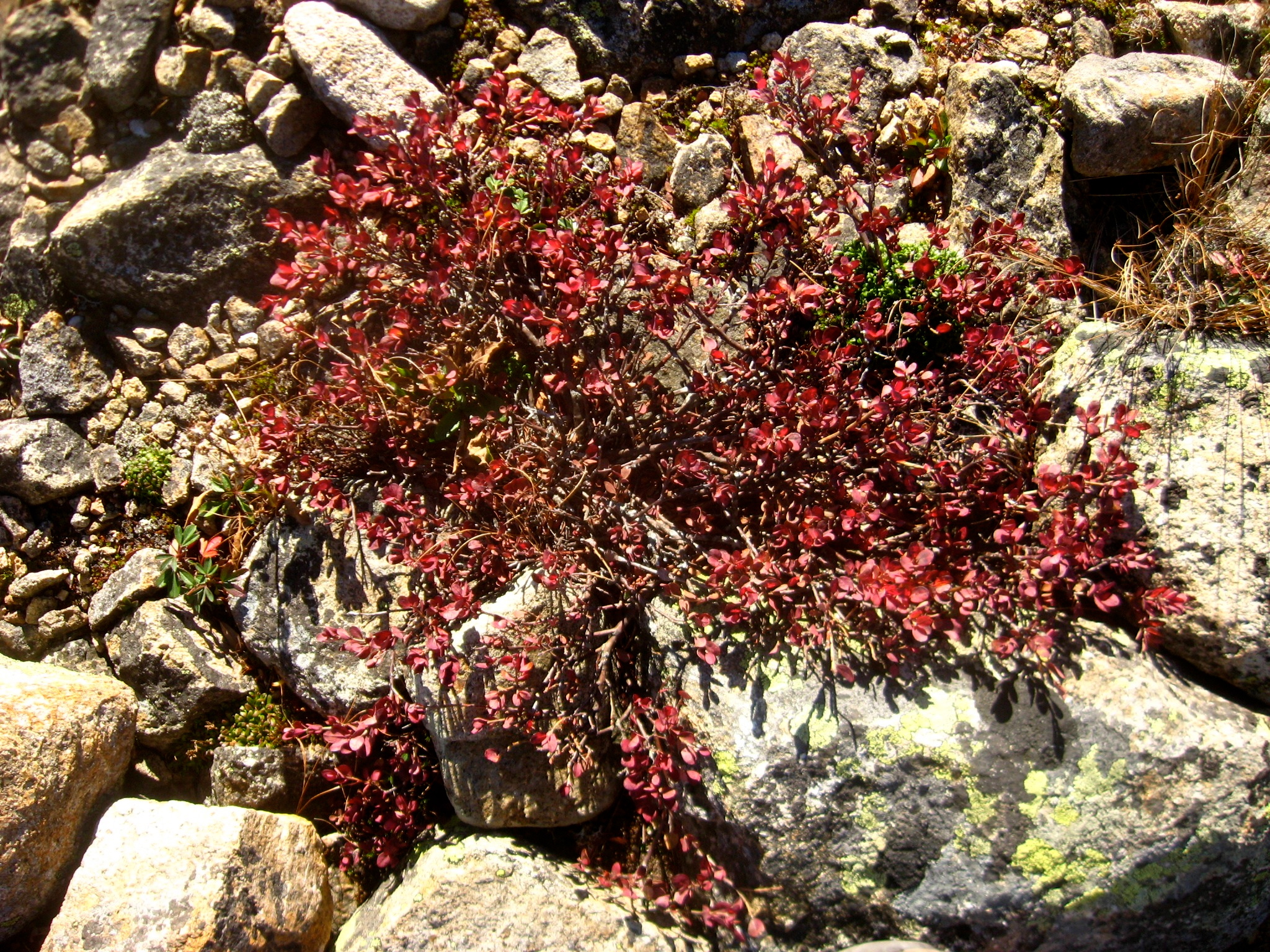
Like Franconia Ridge and Bondcliff, the southern Presidentials were home to a truly fascinating and weird variety of tiny plants, fungi, and lichen. Sideways trees, purple blobs, etc. The works.


On Mt. Eisenhower, below, we were still surrounded by golden grass and patchy knee-high shrubs. However, as we got closer and closer to Mt. Washington, the vegetation faded away. The landscape became starker and starker, and we felt that we were climbing out of the known world, into some alternate reality.
Far ahead we could see the antennae of Mt. Washington’s weather observatory, rising up out of the mass of red-gray rock like the first human settlement on Mars. Between us reared more peaks of angular boulders, rock screes falling sharply to either side. Ahead of us, the rock lines marked a path that was increasingly indistinguishable from the landscape around it.
Paste some neon writing across the sky, print the whole image on cheap fast-fading paper, and you would have a cover right out of the 70’s sci-fi novels that I grew up reading. It was magnificent.


Behind us: Mt. Washington.

Looking back.
The view from the summit of Mt. Monroe (below) was breathtaking: a steep cliff dropped down to a small dip between the peaks, where a tiny, jewel-blue lake nestled in the boulders. On the other side rose Mt. Washington, its antennae and towers more and more visible. Amazingly, one of the huts of the Whites was right there too: Lake of the Clouds, closed for the season, but giving its crew the opportunity to work right on the slopes of Mt. Washington in the summer.

We stopped to check out Lake of the Clouds, which was closed for the season, and then pushed onwards…

Text from the Forest Service sign on the path from Lake of the Clouds hut to Mt. Washington:
STOP
THE AREA AHEAD HAS THE WORST WEATHER IN AMERICA.
MANY HAVE DIED THERE FROM EXPOSURE, EVEN IN THE
SUMMER. TURN BACK NOW IF THE WEATHER IS BAD.
We were warned.

It was October 6th: a clear, sunny, beautiful late-summer day. Not a trace of the dense fog that made the Forest Service decide to mark its above-treeline path with cairns. But as we climbed up the final slope of Mt. Washington, cairns and blazes were the only way to tell the path from the rest of the gray, lichen-covered boulders and occasional grass that made up the mountainside.

We rounded the final switchbacks. A couple descended towards us, dressed in city street clothes, one of them holding a Starbucks cup: the image of urban dwellers coming down an escalator, but transposed onto the highest mountain in New England. We saw a few runners who were trying to cover all the Presidential peaks in one day, dressed in skintight neon suits. We saw a few other people, but not too many. And then…

Then we got to the top and plunged into a different world. People, cars, buildings, and a parking lot were crammed onto the tip of the mountain. The colorful cog railway cars arrived and departed, the wind blew fiercely, people ambled around, and the observatory, with its bundles of antennae and extreme-weather reinforced hulls, looked even more like a space station up close.

At the very top, there was a little sign that said “Mt. Washington Summit”, and a line of forty or fifty people waiting to have their pictures taken next to it. For the most part, they looked cold, huddling against the wind—when they stepped into their cars or the cog railway, two thousand feet below, it had been considerably warmer. But they waited stoically on top of the world, with the surreal observatory tower rising in the background behind them.
It was a more democratic representation than we had seen on a mountain in a long time. People of every age milled around, people with strollers and people with walkers making their ways to the views. They carried handbags, day packs, canvas totes, fanny packs, and everything else. Some looked excited, some looked determined, some looked like their family had dragged them up there. Everyone was taking pictures. No one wanted to linger at the views; there was a constant beeline to the low buildings that housed everything from the cafeteria to the gift shop to the post office–yes, post office. It was a crowd much like you would see at any museum, except that it was also extremely windy and on top of a mountain.
We saw no other hikers who looked like they had climbed the mountain under their own power, let alone anyone carrying an overnight backpack. In fact, we didn’t see anyone whose gear was remotely as dirty as ours, which was probably good for the cafeteria sanitation. It was surreal.
We didn’t make it to the “Mt. Washington Summit” sign, although I did have a good time taking pictures of the people waiting to get their pictures taken.

By the time we left the cafeteria, fortified with clam chowder and fresh water, it was late afternoon. We set off down the northern slope of Mt. Washington, looking ahead to the high peaks of the northern Presidential Mountains: Jefferson, Adams, Madison. We wouldn’t be able to climb them on this trip, but looking out at the low sunlight slanting across their broad slopes, I was already dreaming of coming back.
Somewhere between them was our resting place for the night, although we hadn’t quite decided where.
Above, our view ahead, looking over the valley of the Great Gulf to Jefferson and Adams. Below, one of the cars of the Cog Railway coming down: the tracks passed very close to the trail, and all the tourists waved excitedly.

Soon we were walking along the saddleback ridge between two mountains, with two valleys to either side. To our right, the precipitous drop of the Great Gulf yawned open, already shadowed and dark. To our left, the sun dipped down towards the horizon.
As you can see in the next three photos: I kept looking back to Mt. Washington.


We came over the little peak of Mt. Clayton and stood on the slope of Mt. Jefferson, looking at the guidebook. We had decided to make for the Perch, a shelter below the treeline. The wind was fierce, and the slope was covered in short, stiff grass, which the setting sun turned rosy gold.
To our west, the sun slowly sank into the valley. To our east, a full moon rose over the Great Gulf. Behind us, little pink clouds were gathering around the top of Mt. Washington. The clear weather had come to an end–cold, steady rain would set in the next day, which was why this day had been our last. We took one last look around at the beauty, and then headed down into the trees.


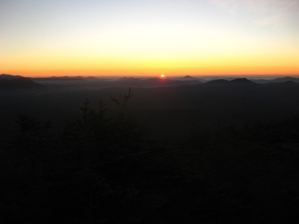
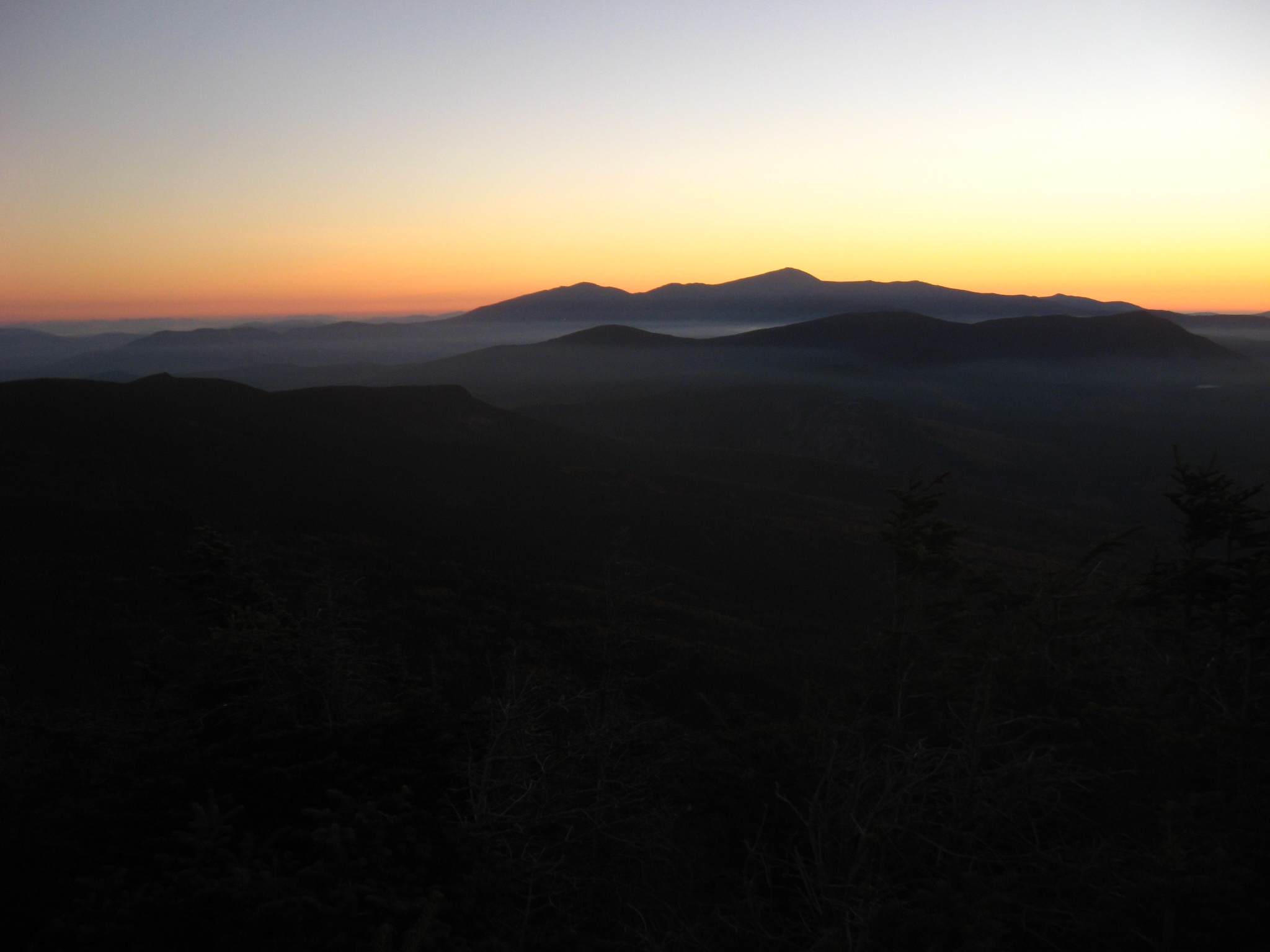
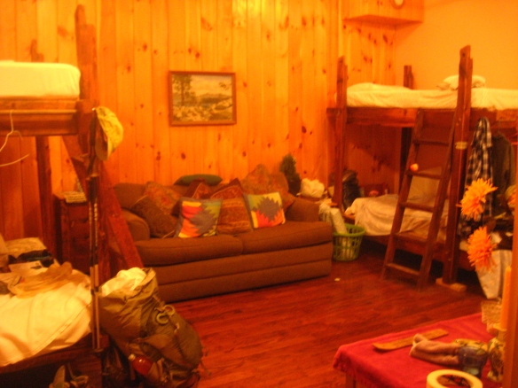
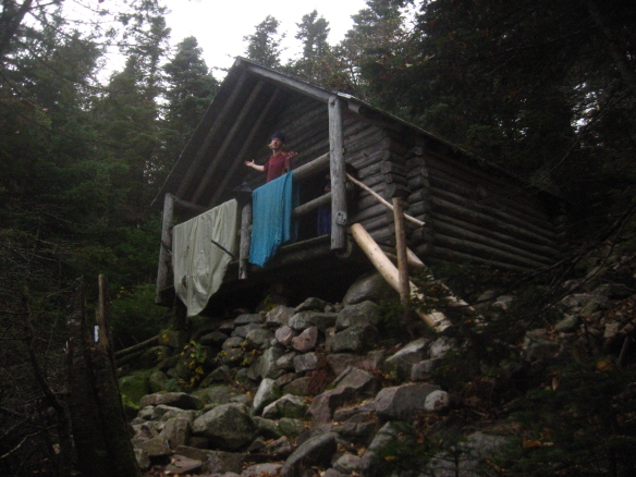 Guyot Shelter, above, was a great place to spend the night. The Appalachian Mountain Club had managed to place a shelter, tent platforms, and a bear box on the steep, forested slope of Mt. Bond. It was as protected as an open, uninsulated structure can be: the fourth side, usually left open, was mostly closed in except for a large door-sized opening, and a ceiling over the porch added additional shelter and luxury. We had it to ourselves, and took advantage of the railings to dry out everything–tent, sleeping sacks, sleeping bags, sleeping mats–that had gotten vaguely damp in the two days of fog. Essentially, we had our own mountain cabin for the night. We wanted to see the sunrise from the summit of Mt. Bond, 0.7 miles from the shelter. We rose in the dark and charged up the mountain in the purple pre-dawn light, seeing shafts of orange starting to spread across the sky, hoping to get there in time. We reached the summit–an open, rocky top with unimpeded 360° view of the Pemigewasset Wilderness–just as the sun was starting to show over the horizon. It was an unusually clear morning. Even the Presidential Range, with Mt. Washington at its center, lacked its usual cap of clouds. The valleys were filled with ethereal threads of fog, but we were in the peaks rising above them.